With just a couple of stops along the way, we made our way into southern California and on to Joshua Tree. We had done a drive-by on the north side on our way to Florida in the fall and we were happy to be able to get back with plenty of time to explore now. We (I) decided to park us on BLM land right outside the south entrance.

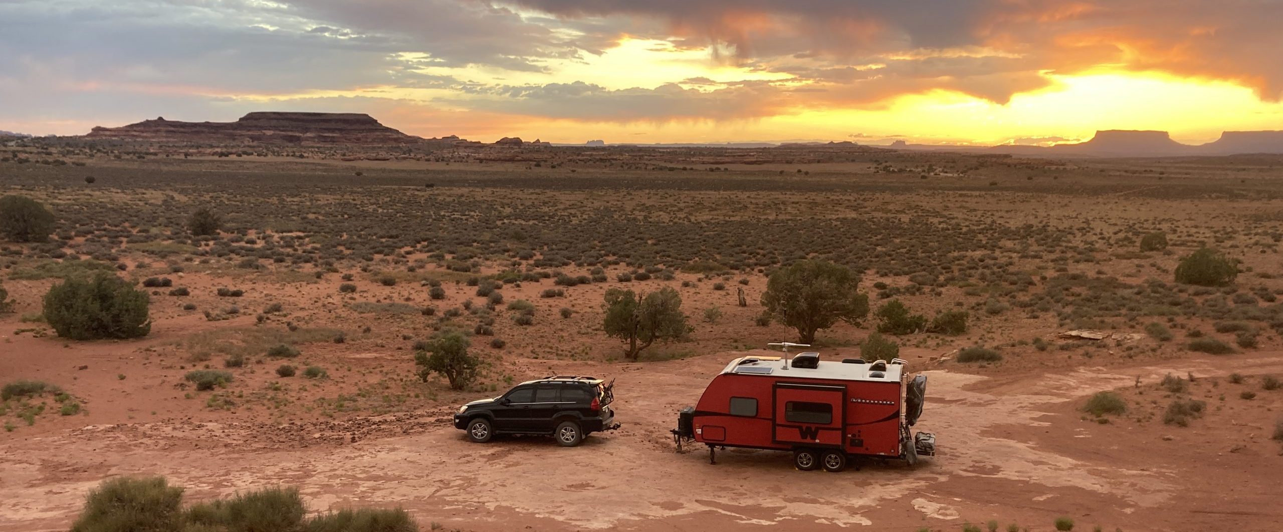
While we were only a few minutes to the entrance, most of the hikes and attractions were on the north side of the park, but we were quite happy with our location. The park is a combination of two deserts – the Mojave and the Colorado and we were camped in the southern, lower in elevation, Colorado. This meant that we were still surrounded by our beloved ocotillos which were pretty much in full bloom. It tended to be quite windy, but with very large grained sand/ small gravel as a base, we had no trouble with dust and it was quite lovely, especially at sunset.


Predicted warm temperatures and our desire to avoid crowds meant that we got up early and headed into the park just as first light was appearing. We got to watch the sun rise as we made our way through the park for the first time and even arrived at the cholla garden just as the sun peeked over the horizon.


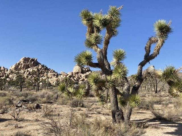
We actually went all of the way through the park in order to exit and come back around to the Black Rock Canyon area on the northwest side in order to do our first hike of the day. We felt a little out of shape as we trudged up an incline through a wash going through Black Rock Canyon. It was beautiful, though, as we were surrounded by Joshua trees and interesting rock formations. The loop led us up to a peak that offered a 360 degree view of the surrounding area – the town of Yucca Valley, the Little San Bernardino Mountains and across to Mounts San Jacinto and San Gorgonio with snow on their peaks. I have to say that we appreciated the views of our immediate surroundings more on the way down, as is usually the case.


Along the trail, we saw a new kind of cactus that looked like a prickly pear without spines. Mike decided to investigate by rubbing his finger along a paddle which is when he discovered that it did indeed have almost invisible spines in each pore that dislodge and stick quite well in fingers. Thus our introduction to the beavertail cactus. Everything is sharp in the desert.

We headed back into the park briefly to gather a map, at which point we realized that we should head back around to the Covington Flats area, again accessed from a side entrance. This area is said to have some of the biggest Joshua trees in the park and we thought it might be a good way to enjoy what would probably be the warmest, busiest part of the day in the park.
Google sent us down a dirt road that was super busy with trucks working on power lines, so once we worked our way around those, we had an uneventful drive in. We saw a group working on cleanup around the road, but other than that, the area was very quiet… and indeed full of Joshua trees. We drove up near Eureka Peak to take the very brief hike to the peak to stretch our legs and enjoy the views. Then on to the Covington Crest Trail to make our way across Upper Covington Flat. Here we had views down into Palm Springs and out to the peaks beyond.


And on the way back, we saw the clean-up crew in action, raking grass and even using a leaf blower on the dirt road, an attention to detail we can’t say we’ve ever seen in a national park before.
Since there were a lot of things that we wanted to do on the north end of the park and it was over an hour away from our campsite, we crammed as much as we could into our first day. We hit up one more area of the park, hiking to the Wall Street Mill and Barker Dam. These combined hikes were a very nice way to end the day as there was very little elevation to deal with. These gave us looks into the recent human history of the area including an old mine that was used to process gold ore and a dam created in a time when there was more rainfall in the area and it could support cattle ranching.


And then we went back to the trailer and rested.
The next early morning saw us headed into the Colorado Desert section of the park, just 15 minutes from our campsite. The Lost Palms Oasis trail led us over rolling desert terrain, through washes and in and out of an incredibly strong wind. We started at a small oasis near the Cottonwood Campground and hiked to a larger oasis tucked into a canyon three and a half miles away. Our legs were feeling the hikes from the day before, but the ups and downs were easier than a summit hike. The oasis was pretty cool to come to at the end of the trail, but the trail itself was amazing – watching the views change as the sun rose and the shadows changed on the terrain around us was beautiful.


We thought we might head down to the Salton Sea, but the afternoon was instead spent on naps and relaxation instead. While the history of the Salton Sea is interesting, it sounded like it would kind of be like the Great Salt Lake – having to pay for an underwhelming and stinky experience. For dinner, we cooked up some fabulous carne adobo to eat on fresh tortillas we had purchased back in Tucson.

The next day was supposed to start with another early hike, but instead started with horrible cramps (for me), so we decided to take the day off. We both needed a day of relaxation and recovery. We were still getting used to hiking again. Our legs were a bit shot and our feet were none too happy either. Mike’s big toenail had turned purple because of unknown trail abuse and he had to go back to wearing sandals to try to keep it comfortable. I had amassed a few blisters. Apparently changing socks was not ok.
We headed out early the next day though, to take advantage of Mike’s last day off before work. We headed to Split Rock to hit a few highlights at once – scrambling on some rocks around Split Rock, the Discovery Trail, Face Rock and Skull Rock. We lost the trail a few times, but made our way back and just loved all of the cool rock formations that were on display.


We then made the move from the south side of the park to the north. It would have made sense for us to do that when we were hiking up there, eh? Oh, well. Temps in the 90s were planned in the south, but the elevation change to the north meant that things would be 15 degrees cooler. There was a patch of BLM land on the edge of Yucca Valley which gave me access to grocery stores and Mike a good cell signal.
This was the first urban patch of BLM land that we had seen and it was kind of sad. It seemed to be a dumping ground – old couches, dumped yard waste, shopping carts from the nearby Walmart, and small trash. It wasn’t terrible, but it certainly wasn’t being take care of. Mike wandered a bit and found little bits of lovely.


We still had quite a bit of time until sunset, so we headed to the Noah Purifoy Outdoor Art Museum nearby.


The rest of our time in the area was spent working and erranding for the most part. I headed back into the park for a couple more solo hikes on the north side – right inside the entrance so it was only 15 minutes away. They were absolutely lovely hikes in a little used part of the park.


