We went back and forth a little about the route we would take to head to Death Valley from Yosemite and eventually decided to head back south to get mostly around instead of over the Sierras. The route was quite a bit shorter and easier and the lure of Lake Tahoe was just not enough to tempt us north.
Luckily, between early work and hike days, we have gotten quite good at early starts on travel days too. We got to the Panamint Mountains outside of Death Valley by early afternoon and paused to look over Rainbow Canyon. Here, a lovely man informed us that there would be no planes. Since we weren’t looking for planes, he had to explain that jet pilots used the canyon for low-flight training, but every other Friday was an “off” day. Oh, well, can’t miss what you weren’t looking for! He listed his must-sees in the park and most of them were already on my list, so we were good to go. Well, after topping off our gas as we were already past zero on the range… again.

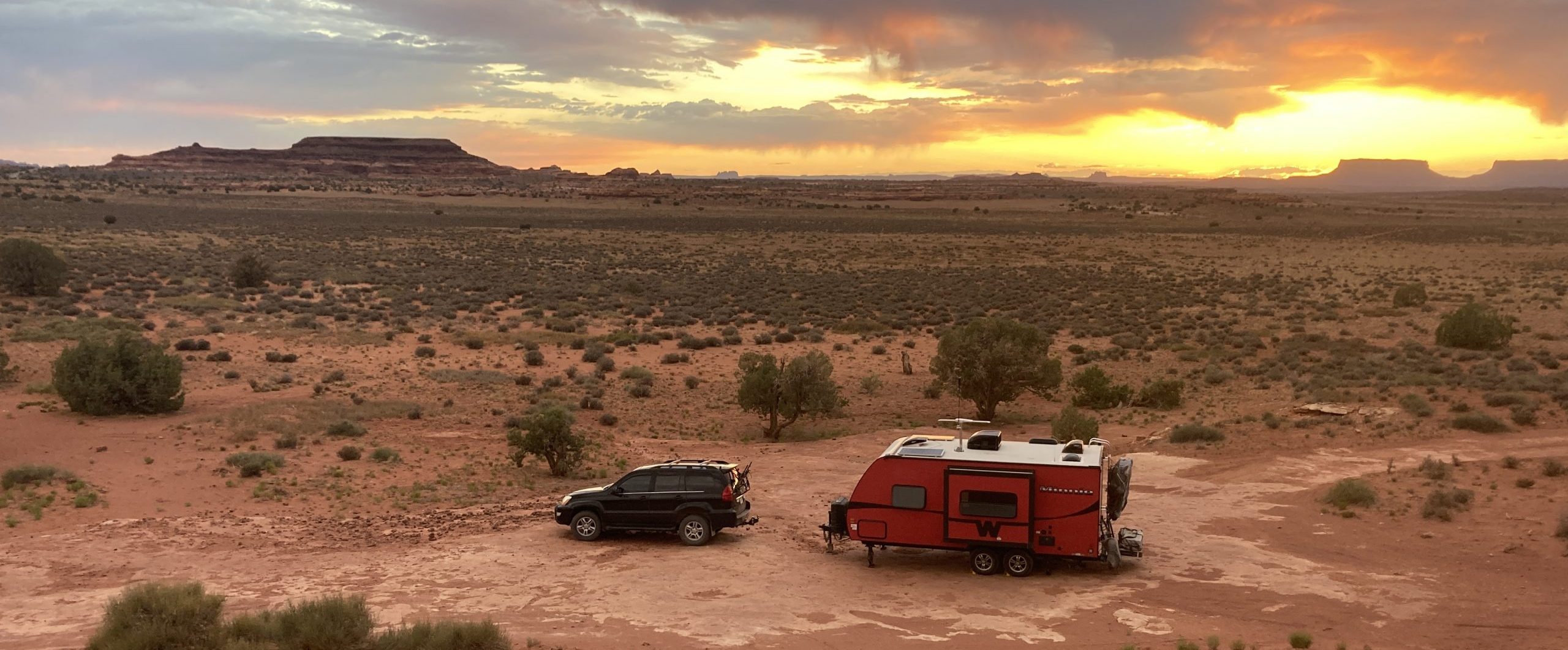
We rolled into Panamint Springs and then climbed the mountains to get our first views of the park. We made our way all the way through the park to our campsite for the duration – an old mining area that had a bunch of cement slabs just a little ways outside of the park. We chose our slab and I did a very poor job of trying to back the trailer onto it. It was only my second attempt at backing up the trailer and a good reminder of why I just leave it to Mike. The added bonus to our site was that it was at about 3000 feet, making it about 15 degrees cooler than in Death Valley.
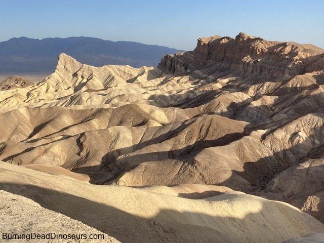
We missed the busier season here by coming later than most people. The temperatures were climbing and most of the campgrounds in the park were closed as of April 15th because of the heat. We lucked out a little because the day we came in the high was 102, but it went down after that. Once more, an early start… this time to avoid the heat. We got to Zabriskie Point just before the sun crested the mountains and drank our tea while enjoying the view.


I had not planned a lot of hikes as I wasn’t very interested in hiking long distances in high temperatures. As we headed toward Room Canyon though, we passed the turn-off for Desolation Canyon and decided to go for it. Our bodies had kind of a hard time getting going, but we got to hike in the shade most of the way in. Near the end, we had to push our way up a steep sandy/ gravelly incline for a view that we decided was probably not worth it. Nice, but not my-legs-are-tired-and-my-sandals-are-full-of-sand-but-its-worth-it nice. At least the way back was downhill.


We made our way to the next hike which was on the other side of Badwater Basin. I had researched, but not done the usual prep for hiking in areas where we have no cell service. We use Gaia GPS for our map needs and tracking, but often find hike info on AllTrails. I looked briefly at hike info, but did not take pictures of the trail info or read deeper into reviews. This led to a little confusion on the next hike.
We had to compare a not so great map from AllTrails to our very detailed map on Gaia as we tried to first make our way into the right canyon and then find the slot canyons that led to “rooms.” We certainly did some off-plan exploring, but really enjoyed all of the different terrain and rocks around us. We even had shade on and off as we made our way through the canyon, which was wonderful as it was getting really hot. Our expectations for what was billed as a slot canyon pay have been a little high after our experiences in Spooky and Peek-a-boo in Utah. We lowered our slot expectations accordingly and just enjoyed all of the other aspects of the hike.


The hike was a lot of fun, but the best part was kind of a bonus discovery. As we scrambled about, we had to do quite a bit of climbing, grabbing onto rocks and pulling ourselves up. Nothing too crazy, but up to this point, Mike had been avoiding using his hands as much as possible, or wearing gloves to protect them. By the time we did this hike, his eczema had recovered enough that he did not damage his fingers at all! Up to this point, it would take almost nothing to crack a finger tip open – holding a paddle, washing dishes, grabbing onto a rock. It was seriously cause for celebration.


By the time we got back to the car we were ridiculously hot and grateful for air conditioning. We made our way back through the valley, stopping at the more visited points – Badwater Basin (lowest elevation in the US- 282 feet below sea level), the Devil’s Golf Course, and Artists Palette. They were all interesting to see, some not so interesting when captured on camera.


The only downer in all of this happened when we trekked up a good-sized hill to view Artists Palette, a range of mountains that contained a myriad of colors caused by the oxidation of different metals in the rock. Just before the top, one of my flip flops broke. I hobbled up the rest of the way and most of the way back down on one flip, slowing and eventually stopping to wait for Mike to get back from the car with other sandals.


And then back to the relative cool of our campsite.
The next day we headed west back across the canyon to Mosaic Canyon. This was my favorite hike in Death Valley. In morning shade, we climbed into a beautiful canyon of swirled marble interspersed with a mosaic of aggregate called breccia. We walked through wide valleys and pulled ourselves up through narrow openings. We hiked on hillsides and and followed rock arrows to find the easier path. And when we got to the end, we knew it.


The rest of our time was taken with checking out exhibits – Saltwater Creek where we saw tiny pupfish cavorting in the saline water, Furnace Creek where we learned about Borax gathering and refining, and 20 Mule Team Canyon where we did not see any mules, but did see amazing hills and mountains on the backside of Artists Palette.


There was much more that we could have done in Death Valley, but we decided to move on. It was still quite warm, bodies were tired and gas was incredibly expensive ($5.54 / gallon). Onward we went that afternoon!